Wednesday, 11 July 2012

The Length of Long Island

If from space Kennebecasis Island appears to be like a morsel in the jaws of the monster-like Kingston Peninsula, then Long Island appears to be like a pilot fish on the Peninsula's flank.


Long Island, with its current permanently residing population of zero, is not the world famous Long Island, but it does represent the largest of all the numerous islands of the Saint John River system. It is 4.5 miles long and more than a mile wide at its broadest. Long island is similar to Kennebecasis Island with its history of settlement by a small, but hardy, community of farmers. These pioneers gradually gave up scraping an existence in relative isolation and were then subsequently replaced by seasonal vacationers and their respective summer cottages, which are scattered along the shoreline today.


This journey would be the this summer's longest to date and the trepidation of the first mate and crew were made obvious in the way that we left our mooring. Once out into the Kennebecasis River we set sail upstream past Burnt Island and the ferry that runs back and forth between Millidgeville and the Kingston Peninsula.


The river was relatively free of boats with the wind light and the humidity building. As Long Island came into view, I overheard another reason for the nervousness of the launch; the possibility of thunderstorms. The sun was now cutting sharply into my gunwales, after an overcast beginning to the journey, and I felt a storm would be unlikely.


We passed the southwest point of Long Island with the affluent, suburban community of Rothesay off my starboard bow. Long Island at this point consists of rolling hills and forest, with the only apparent clearing the small sandy coves at the water's edge. To be honest, I was paying more attention to the horizon, where at Rothesay Yacht Club, cute dinghies were zipping back and forth in competition.


As we headed in a northeasterly direction the island became more rugged and it is here where Long Island's most prominent feature can be seen. Minister's Face is a cliff on the island's southern shore that rises in spectacular fashion, broken but sheer, from the river. We marvelled at it as we slowly sailed by, its cliff face dwarfing my mast.


Beyond Long Island, to the northeast, is a small neighbouring island called Mather Island. This island was once used as a summer vacation destination for Saint John's orphans. The original plan was to circumnavigate Mather Island but the first mate and crew, despite my protestations to continue, would not risk the potential of being grounded in the narrow passage that separates the islands. We backed off and sailed around its southeastern and then northwestern coast, bearing towards the Kingston Peninsula side of Long Island.


From here, looking over the Kingston Peninsula to the north, white clouds could be clearly seen bubbling higher and higher into the humid atmosphere. 


A storm felt a much greater possibility.


With the wind in a southwesterly direction we were having much fun tacking back and forth between Long Island and the Kingston Peninsula, gradually making our zig-zag course downriver. We were having so much fun in fact that we didn't notice that the sky was darkening. As we made our way past the southern portion of the island I felt the rumble of thunder through my hull.


As a sailboat, nothing scares me more than a lightning storm. Okay, with the exception of a shallow coral reef in combination with wild seas and an oil tanker bearing down on me, nothing scares me more than a lightning storm. Luckily my fear was only matched by the first mate and crew, who immediately made for the coastline of Kingston Peninsula. We then hugged the coast, waiting to see if the storm would break over us.


The first flash of lightening confirmed our fears and we dropped anchor by a small cove. Here the first mate and crew abandoned me to fend for myself, to see if my small but perfectly formed mast would be prominent enough to attract a fork of lightening that would blow me out of the water and into sailboat heaven.


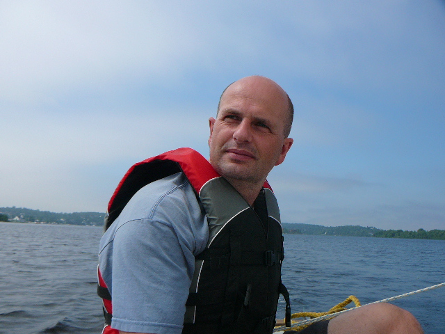
The next thing I felt was a squall of wind hitting me full across my beam, making me drag my anchor. The first mate, bless his bald pate, jumped into the water grabbed my stern line and tied me securely to a limb of a nearby tree.


The rain was torrential and the wind blasted me for the next three quarters of an hour, but the storm blew out as quickly as it had arrived. The first mate and crew, drenched and cold, were keen to set sail and we made for the gap between the Kingston Peninsula and Long Island's southern most point.


By the time we had negotiated our way down river past the Millidgeville to Kingston Peninsula ferry back to RKYC, the sun was shining and it was as if the storm had never occurred. In fact, the only give-away was the shaking hand with which the first mate gripped my stead fast tiller.


Temperature: 25C
Wind: slight to moderate (squalls)
Length: 23 miles
Duration: 7 hours (including 1 hour at anchor)


Saturday, 7 July 2012

Picnic at McCormack Cove

McCormack Cove is is Kennebecasis Island's most striking feature; a huge gouge in the southern flank of the island that almost splits the island in two. It is named after the most notable of the families that farmed the island in the 19th century.


When the wind is in a northerly direction the cove can be a sheltered spot for a picnic. But I was surprised with the choice this evening given the south westerly wind, that meant that all the gusts would enter directly into the cove without any shelter.


However, the purpose of this trip, it soon became clear, was not only to have a picnic in scenic surroundings but to provide testing conditions for some tacking practice by the crew.


McCormack Cove is wooded with a prominent headland jutting out from its centre, and a few of the island's summer cottages add to the pleasant surroundings. One particular cottage reminded the first mate and crew of their cottage they once owned in Northern Ireland.


Temperature: 22C
Wind: Moderate
Length: 6 miles
Duration: 1.5 hours


Friday, 6 July 2012

Traversing the St. John River

We sailed out between Indian Island and Ragged Point with the wind light and from the north west. There was plenty of opportunity to admire the high-end houses that cling to the steep sides and line the small coves of the rugged terrain.


Once around the final headland we moved out of the Kennebecasis River and into the St. John River. This area is known as Grand Bay and is a spectacular sight with a wide expanse of water due to both rivers being well over a mile wide when they join. To the south the start of the relatively narrow and gorge-like outlet of the St. John River can be viewed where the river angrily and noisily spills into the cold water of the Bay of Fundy through the Reversing Falls. However, rather than heading south we set a direct course across the St. John River to one of RKYC's neighbouring boat clubs Saint John Marina.


When we were about 100 yards from the marina a course was set south towards South Bay. At the entrance to the bay two giant pylons provide the height required for electricity cables to span the half-mile wide stretch of water. We followed these wires from west to east and to the south we could make out cars glinting in the bright sunshine in the car park by the beach at Sand Cove.


We tacked back across the St. John River, past the new houses being built on the Anchorage and back past Ragged Point to a smooth docking at RKYC.


Temperature: 25C
Wind: Light
Distance: 9 miles
Duration: 3 hours


Postscript


Later that day my crew and first mate eloped onto a larger sailing boat for a similar voyage across Grand Bay. I was very jealous because I couldn't help but notice them admiring its towering mast. Afterwards, they told me that they felt guilty for their transgression and asked my forgiveness.


A sailboat may forgive but never forgets!

Monday, 2 July 2012

Circumnavigating Kennebecasis Island

From space, Kingston Peninsula must look like a giant 20 mile long river monster, its head jutting south west and separating the St. John River from the Kennebecasis River. The morsel it appears to be about to capture in its formidable jaws is Kennebecasis Island.


From the river, Kennebecasis Island is a lot more significant than a mere morsel. Through the 19th century the island supported a small community of pioneering farmers, and even their children went to school on the island. Today the island is home to a cluster of summer cottages and their residents, who take advantage of the cable ferry that runs through the months when the river is free of ice. It was therefore an interesting and challenging choice that the first mate and crew made to sail around this island.


The wind was moderate and the sun was still high as we sailed directly off our moorings. The mainsail was raised first and it was a pretty smooth launch when compared with the slap-stick effort of the first voyage. We headed north past Goat Island at a steady pace directly towards the 400 yard wide channel where the cable ferry was busy transporting vehicles back and forth laden not only with their passengers, but with the food and drink that would allow them to celebrate Canada Day in a suitable fashion. 


In the narrow sheltered channel our speed dropped and as we passed the island's Keith Cove we had plenty of time to admire all the sailboats and motor cruisers moored up and decked out with their Canada Day bunting and flags. As we passed through Milkish Channel and headed west we could see a covered bridge on the peninsula. We tacked south west as the island narrows and the channel widened and there was less shelter from the wind. The size of the waves gradually increased.


By the time we left the channel both my bow and stern lines were trailing behind in the water and soon after the first crew's cap became the first casualty lost over board. The second casualty was the camera which succumbed to water damage. Spray from the waves' white caps was soaking the crew and first mate and it tickled my coamings as we sailed close hauled to clear the island's westerly headland. This, I remembered, was why I had dreamed of returning to the river.


Once we cleared the headland we set a quick course directly back to RKYC where the masts of the remaining sailboats at their berths could be seen on the horizon. As the sailing became easier, I could sense sighs of relief from the crew and first mate. I wanted to return to the waters off that headland, heel right over and hear my hull slam against the waves once again. 


I am sailed therefore I am.


Temperature: 25C
Wind: Moderate
Length of Voyage: 10 miles
Duration: 2.5 hours


The Voyage of the Three Islands

This morning there was a cool refreshing mist coming off the cold waters of the Bay of Fundy that rolled over the hills of Saint John down into Millidgeville. First mate and crew were at the moorings and I could sense their anticipation and excitement. They hurriedly fixed my stays in place with new, shiny pins and then they fitted the jib and mainsail in preparation for raising.


In the past I have had a small motor fitted to my stern, but the first mate claims he has a sailing purists ideology and that we must sail (or if required paddle) off our mooring. I notice that nobody else shares his ideology at RKYC. I also notice that they didn't feel confident enough to sail off the moorings this time but instead paddled out into the river before desperately fumbling at my halyards as they raised the jib and mainsail. Again, there were some profanities that I did not approve of!


Obviously they were not very confident on this, their maiden voyage. 


We set off at an overly leisurely pace, as they got to grips with my tiller and sheets, from the little bay in which RKYC is located towards Burnt Island.


Burnt Island is located only 100 yards off the mainland. A circular shaped, steep sided, rocky island roughly 250 yards across and covered in forest, it looks the perfect location for the lair of a James Bond villain. However, as far as I can see the island is uninhabited.


As you approach the island you pass Tucker Park. With its beach it is a popular location for Millidgeville residents who wish to swim and paddle in the relatively warm waters of the river. Overlooking the island from the mainland is a Gothic style mansion, but none of this seemed to be the focus of the first mate and captain who, at the slow pace of sail, were having to fight off ravenous horse flies.


Once (eventually) past the island we headed north and gathered speed before heading down river in the direction of Goat Island and Indian Island. These two islands are located about half a mile south west of Burnt Island. From the air, I have been told, they resemble two huge whales, the large Indian Island chasing the smaller Goat Island.  There is a shallow channel of water 100 yards wide separating the two. Like Burnt Island these islands are uninhabited but are both popular with the Saint John kayaking fraternity who, during the summer months, will often camp and party on the islands' beaches.


We passed to the south of Goat Island before tacking north through the narrow channel separating the islands. This maneuver would not be undertaken by large sailboats, but with my draft being little more than two feet and the river being high after recent storms there was little risk of grounding on the sand bar.


From here we set a course parallel to the northwest shore of Indian Island heading towards Ragged Point on the mainland. This is the location where the Kennebecasis River joins the St. John River. A southerly tack, followed by a course in a north easterly direction along the southwest coast of Indian Island led us back into the narrow channel once more. Once through we completed a figure of eight around the two islands.


With the sound of rumbling stomachs resonating from the crew and first mate, the voyage was almost complete and we headed towards RKYC, which was half a mile to the south. I was pleasantly surprised, albeit in easy sailing conditions, how these two apparent novices had coped. But my exasperation was soon rekindled.


Coming back towards the moorings there was much panic trying to get the sails down in good time while staying in control. Meanwhile larger boats, travelling out from RKYC, pushed their way past seemingly oblivious to the confusion. Eventually, with sails half down and flapping in the wind the first mate and crew paddled the remaining 100 yards to the mooring and a well earned rest.


Temperature: 20C
Wind: Light
Length of Voyage: 5 miles (4.3 nautical miles)
Time: 2.5 hours

Sunday, 1 July 2012

Onto the River

Today a crane pulled up to my cradle, complete with a couple of slings, and my excitement built. This cradle had been my prison for over four years and I longed to be free.


Two men carefully tied the slings around my hull on either side of my keel and hoisted me out of the cradle to swing gently in the breeze. The crane then drove gently down the hill. On my port side was the historic Royal Kennebecassis Yacht Club (RKYC) building with its tower soaring even higher than the tallest mast. To my starboard side, resting on their berths, were a host of sailing boats and motor cruisers of all sizes and shapes. Despite me feeling very small among these boats, I felt that once my mast was raised I would be made to feel welcome.


The crane gradually lowered me onto the river, and I could feel all the people around me hold their breath. If I sank now, I wouldn't be the first, or no doubt be the last. However, everything went well and I bobbed up and down, feeling the caress of the water.


Next, a follically challenged fellow (I am a polite boat) with a strange accent hopped ponderously aboard. He grabbed the tiller, and with the help of a small motor boat, I was slowly towed out towards my new mooring.


"A" Dock would be my new home among a menagerie of the smaller vessels at RKYC. My nearest neighbours are a pontoon boat and a sailboat of similar size and vintage to me. I hope we can be friends! On the other side of "A" Dock are the larger boats, a mixture of sailing yachts and large expensive motor cruisers. These boats don't seem to speak to us much, but generally face towards other large sailboats moored on "B" Dock.


After a brief period, so that I could settle in, the follically challenged fellow (I will call him "first mate") and a lady with a similar strange accent (I will call her "crew") came back with the obvious intention of raising my mast. This was something I was particularly looking forward to. Although short, my mast is perfectly formed and once raised, my potency would be returned.


I tried to keep as steady as possible in the water, but I have to admit that there were some mild profanities from the first mate, something I do not approve of. Anyway, after much huffing and puffing, the mast found the hole in my cuddy and slotted into place.


One thing I didn't tell the first mate and crew was that I was missing a few pins, so the job of completing my standing rigging would have to wait for another day. Despite this, I cannot begin to explain how happy I am to be back in the water, my mast raised, and feeling, once again, like a sailboat.


Friday, 29 June 2012

On the Move


At last I'm on the move. Not under the power of my sails, unfortunately, but a few nice men brought around a tow truck, jacked the cradle and me up, and pulled me through the streets of Saint John - destination Millidgeville.


The last time I was at Royal Kennebeccasis Yacht Club was over four years ago, and the place hasn't changed much. I call it home.


My crew seem to like me a lot. They must do as they have painted my bottom and waxed my coamings! I have a new blue bottom, and after a good wash and scrub, feel nice and clean. I could swear I don't look a day over 30. I feel so excited, I can't wait to feel the brush of water against the side of my hull once again.